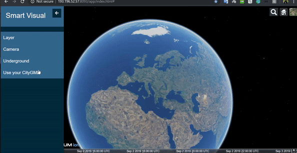
STT HFT Stuttgart Projects
Employing OGC Standards to Smart Cities.
The Steinbeis Transfer Center Technology
Consultancy @ HFT Stuttgart
OGC Testbed 18 - Future of Open science and Building energy interoperability (FOB)
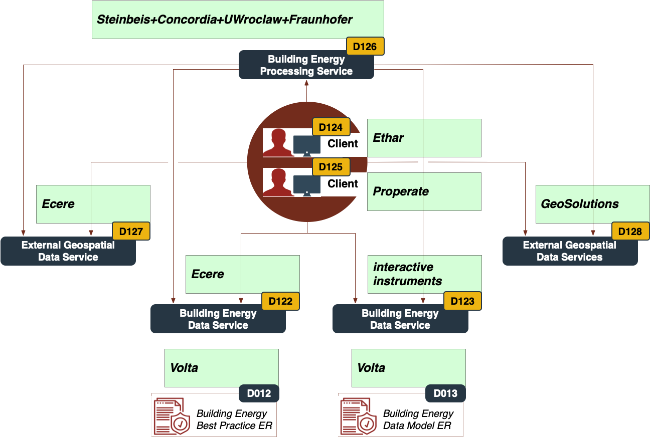
Building Energy Spatial Data Interoperability
Energy building spatial data interoperability allows us to explore interoperability within domains, where specific data and knowledge paired with established and emerging systems pose various challenges to interoperability and data integration. The topic is hotter than ever before with the current sky-rocketing energy prices. It addresses how to build robust platforms for a specific community that bridges all the way from raw data to decision-makers. The participants and their roles are presented in the figure below:
Important Links:
STT OGC API - Process for SimStadt API
About OGC Testbed 18
OGC Testbed 18 Engineering Report
OGC Interoperable Simulation and Gaming Sprint (ISG) Year 2
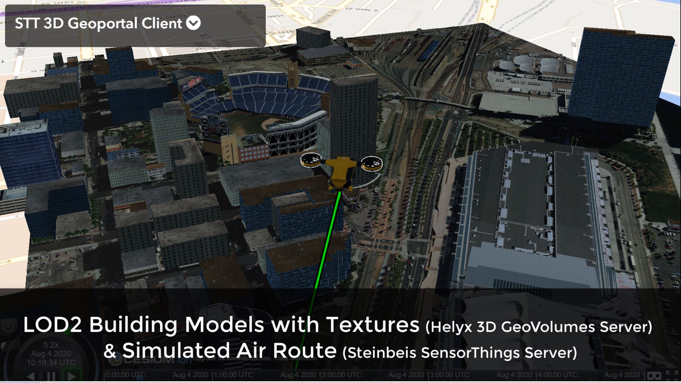
The Interoperable Simulation and Gaming (ISG) Year 2 initiative will build on momentum established during the recently completed ISG Sprint (year 1), documented in the ISG Sprint Engineering Report. Additional results are demonstrated in this YouTube Playlist. This OGC Innovation Program initiative will advance geospatial interoperability of systems exchanging 3D content. OGC is working with the Khronos Group and various OGC Working Groups to advance interoperability of 3D geospatial and computer graphics using OGC CDB, Khronos glTF, and related 3D standards. Prototyping work is advancing interoperability for Geospatial Intelligence (GEOINT) Processing, Exploitation, and Dissemination, as well as open standard interfaces critical to enabling novel combinations of emerging technologies to bridge Special Operations Forces (SOF) capability gaps.
Important Links:
To STT 3D GeoVolumes API Server
To STT SensorThings Server
To OGC Official Site
OGC ISG Sprint Year 2 Engineering Report
Demo on OGC YouTube
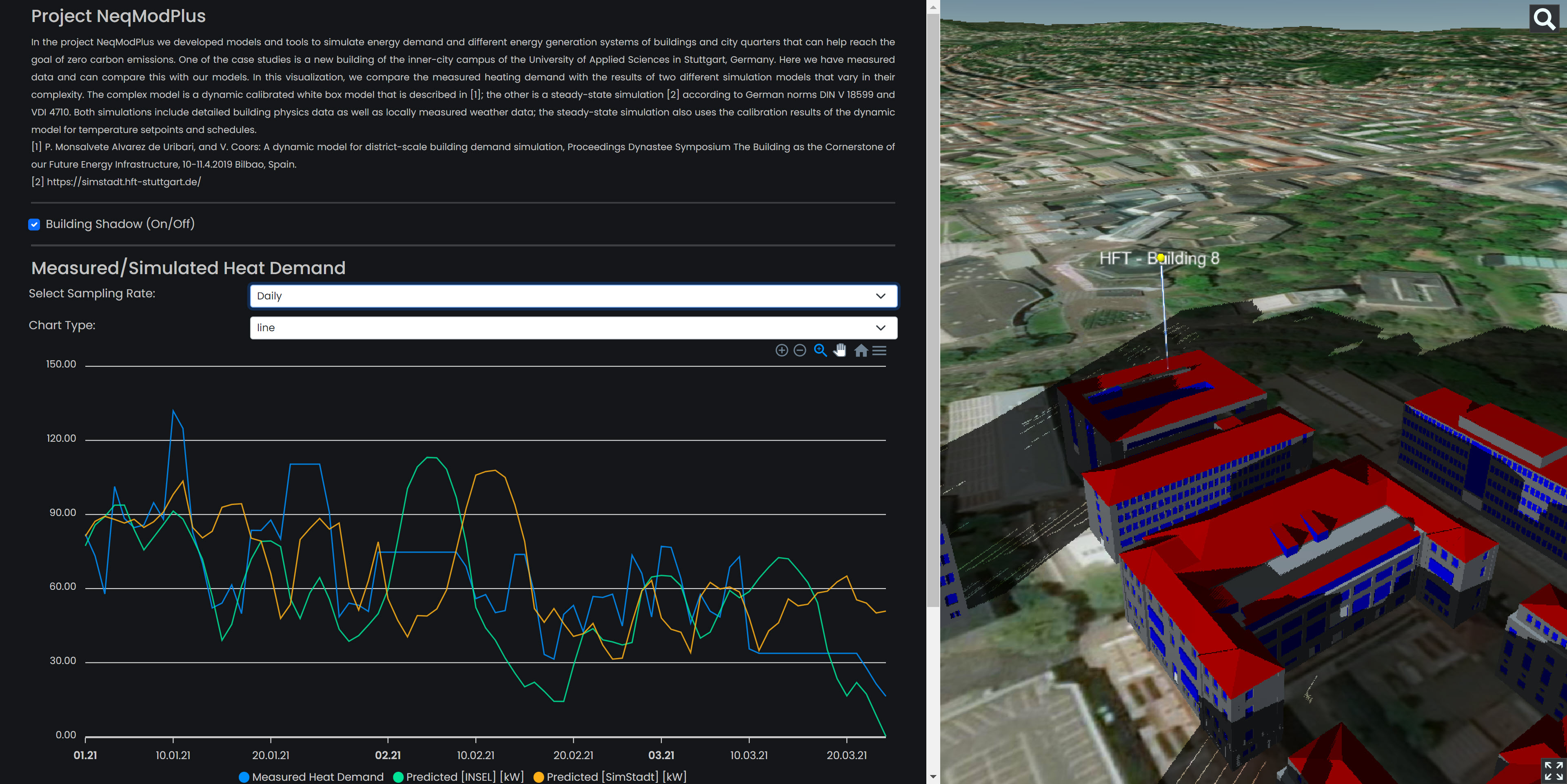
Project NeqModPlus
In the project NeqModPlus we developed models and tools to simulate energy demand and different energy generation systems of buildings and city quarters that can help reach the goal of zero carbon emissions. One of the case studies is a new building of the inner-city campus of the University of Applied Sciences in Stuttgart, Germany. Here we have measured data and can compare this with our models. In this visualization, we compare the measured heating demand with the results of two different simulation models that vary in their complexity. The complex model is a dynamic calibrated white box model that is described in [1]; the other is a steady-state simulation [2] according to German norms DIN V 18599 and VDI 4710. Both simulations include detailed building physics data as well as locally measured weather data; the steady-state simulation also uses the calibration results of the dynamic model for temperature setpoints and schedules.
[1] P. Monsalvete Alvarez de Uribari, and V. Coors: A dynamic model for district-scale building demand simulation, Proceedings Dynastee Symposium The Building as the Cornerstone of our Future Energy Infrastructure, 10-11.4.2019 Bilbao, Spain.
[2] https://simstadt.hft-stuttgart.de/
Important Links:
To the Application
To NeqModPlus SensorThings Server
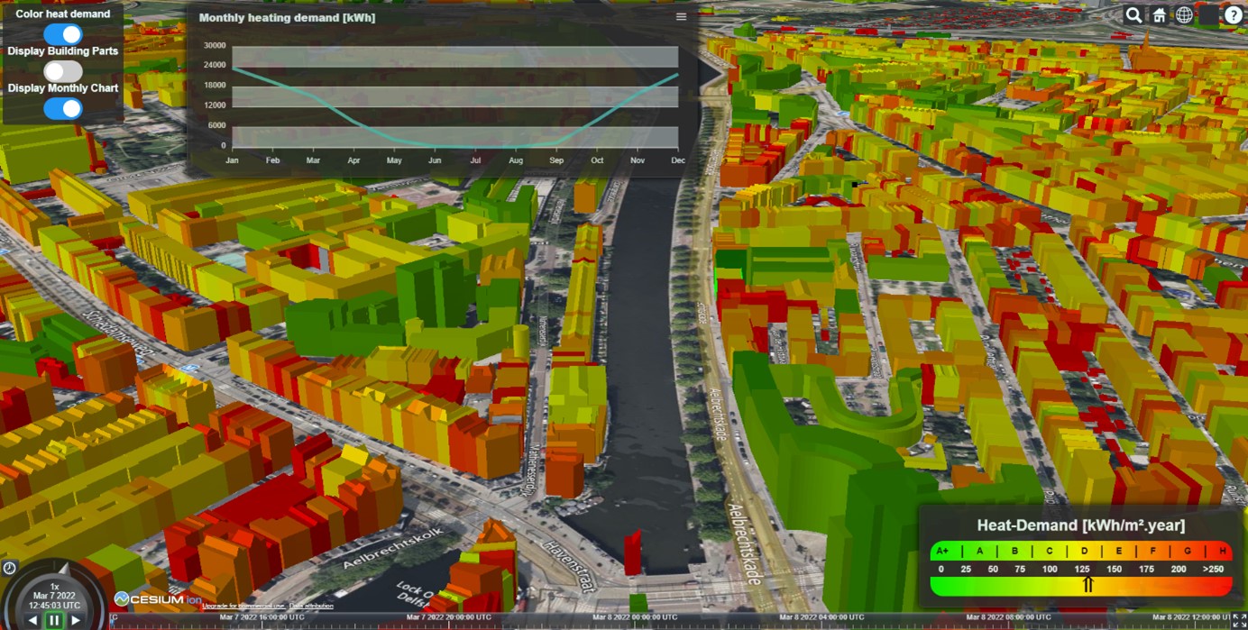
3D Rotterdam
Visualization of heating demand simulation results using 3D Tiles. Simulation was done using SimStadt with an adopted building physics library for Rotterdam and CityGML (open data)
Important Links:
To the Application
OGC Interoperable Simulation and Gaming (ISG) Sprint
The goal of the Sprint is to advance the use of relevant OGC and Khronos standards in the modeling and
simulation community through practical exercise and testing of the draft specification produced by the
3D Data Container and Tiles API Pilot. Of particular interest is the handling and integration of glTF
models coming from multiple sources. There is secondary interest in the spec's implementability,
consistency, completeness, and maturity. Implementation experiences obtained from the Sprint will
advance the interests and work of the OGC Interoperable Simulation and Gaming Domain Working Group (ISG
DWG) and of the OGC Standards Baseline in general.
Important Links:
To STT 3D GeoVolumes API Server
To STT SensorThings Server
To OGC Official Site
OGC ISG Sprint Engineering Report
Demo Playlist on YouTube
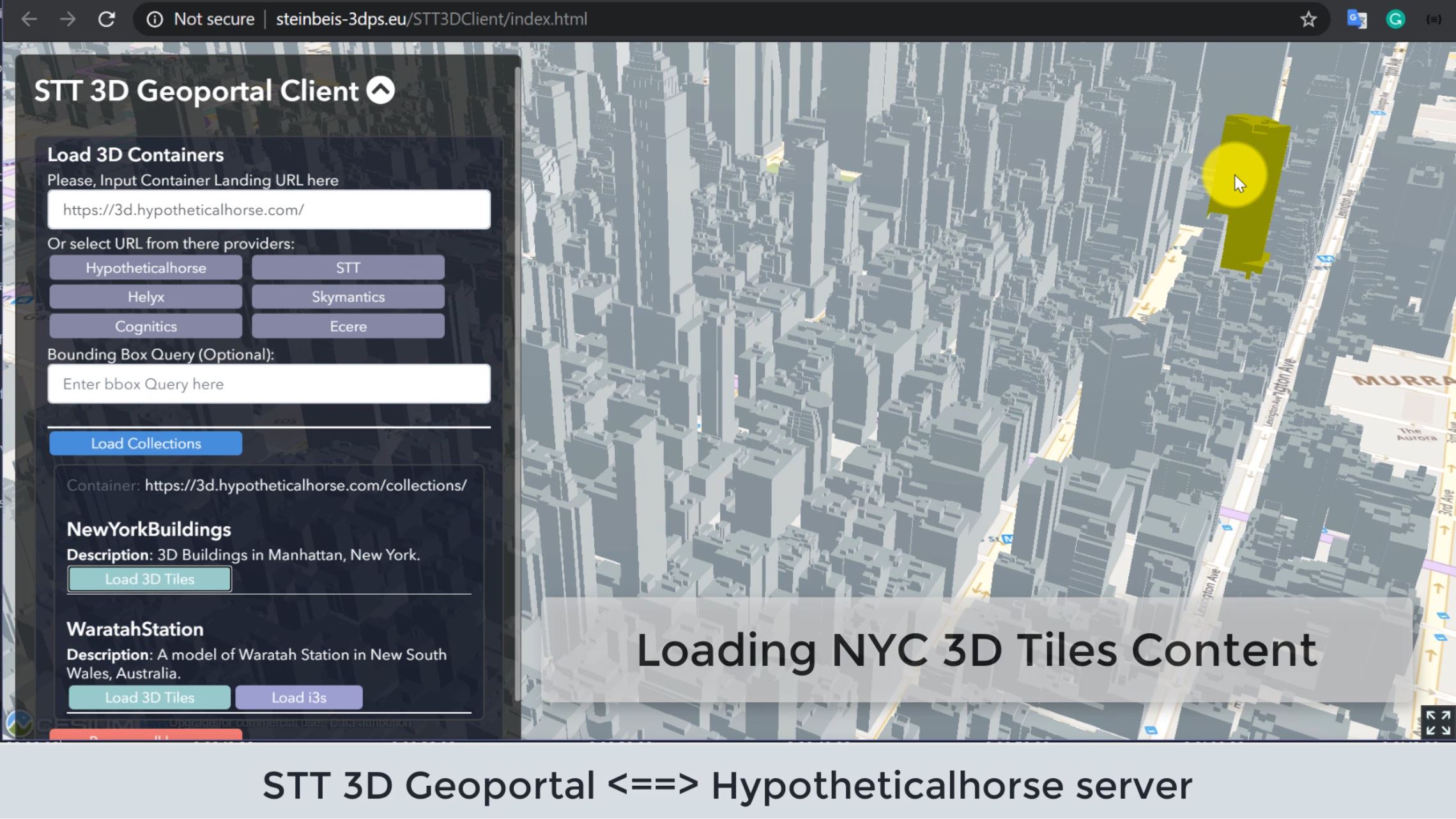
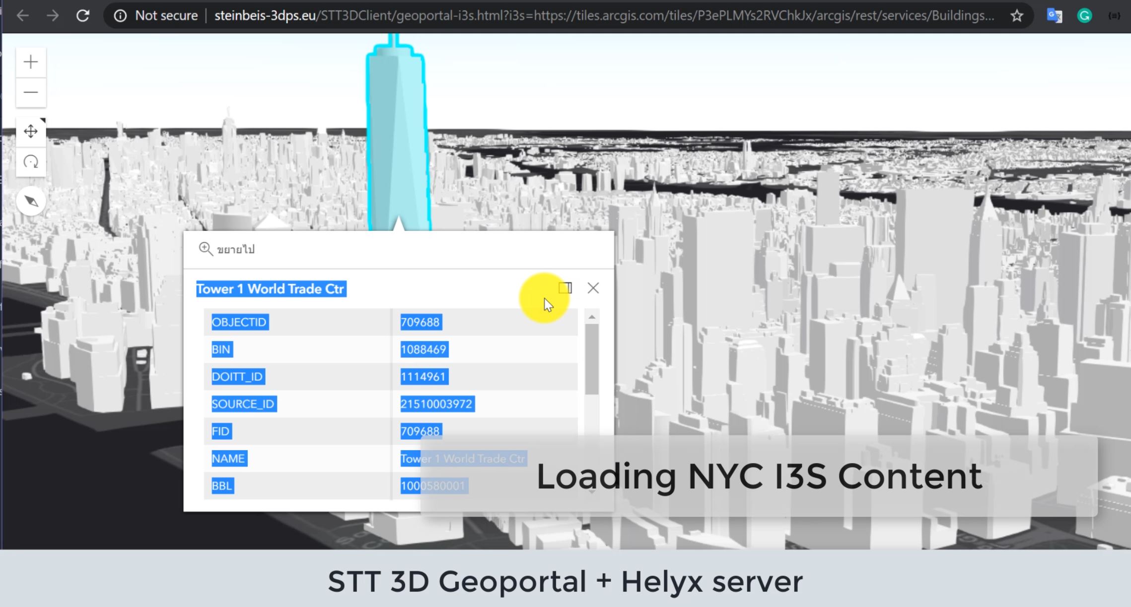
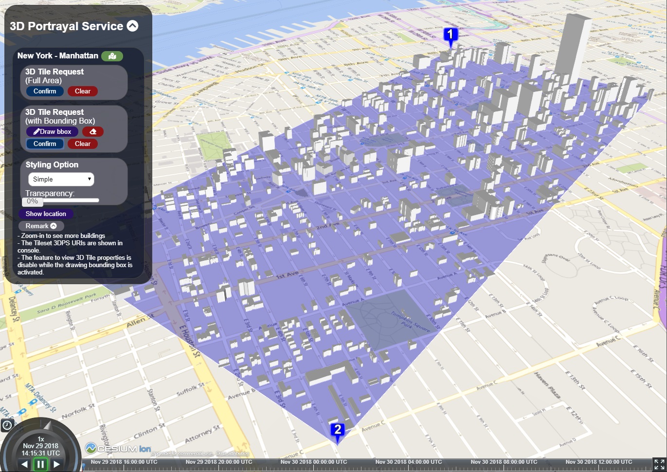
OGC 3D Data Container and Tiles API Pilot
The goal of the 3D Data Container and Tiles API Pilot is to explore an integrated suite of draft
specifications for 3D tiled geospatial resources and compatibility with existing OGC 3D delivery
standards such as the 3D Portrayal Service, I3S, and 3D Tiles Community Standard. This suite will
support smooth transitions between 2D and 3D environments; allow applications working with 2D tiled
resources to get 3D tiled resources; and enable 3D tile bounding volumes to support multiple data
containers.
To achieve these goals, the Pilot will develop a draft API that is compatible with the OGC API group of
standards (and candidate standards) and which allows access to, and query of, 3D geospatial data and a
corresponding container format for streamed data delivery compatible with glTF. The Pilot funds a number
of data server and client implementations to test the new API and data delivery. Further, the Pilot will
include an analysis of characteristics and capabilities of the new API in comparison with existing or
emerging 2D standards.
Important Links:
To STT 3D Container and Tiles API server
To OGC Official Site
3D Data Container Engineering Report
OGC API - Tiles - 3D (GeoVolumes) Engineering Report
3D Data Container and Tiles API Pilot Summary
Engineering Report
Demo Playlist on YouTube
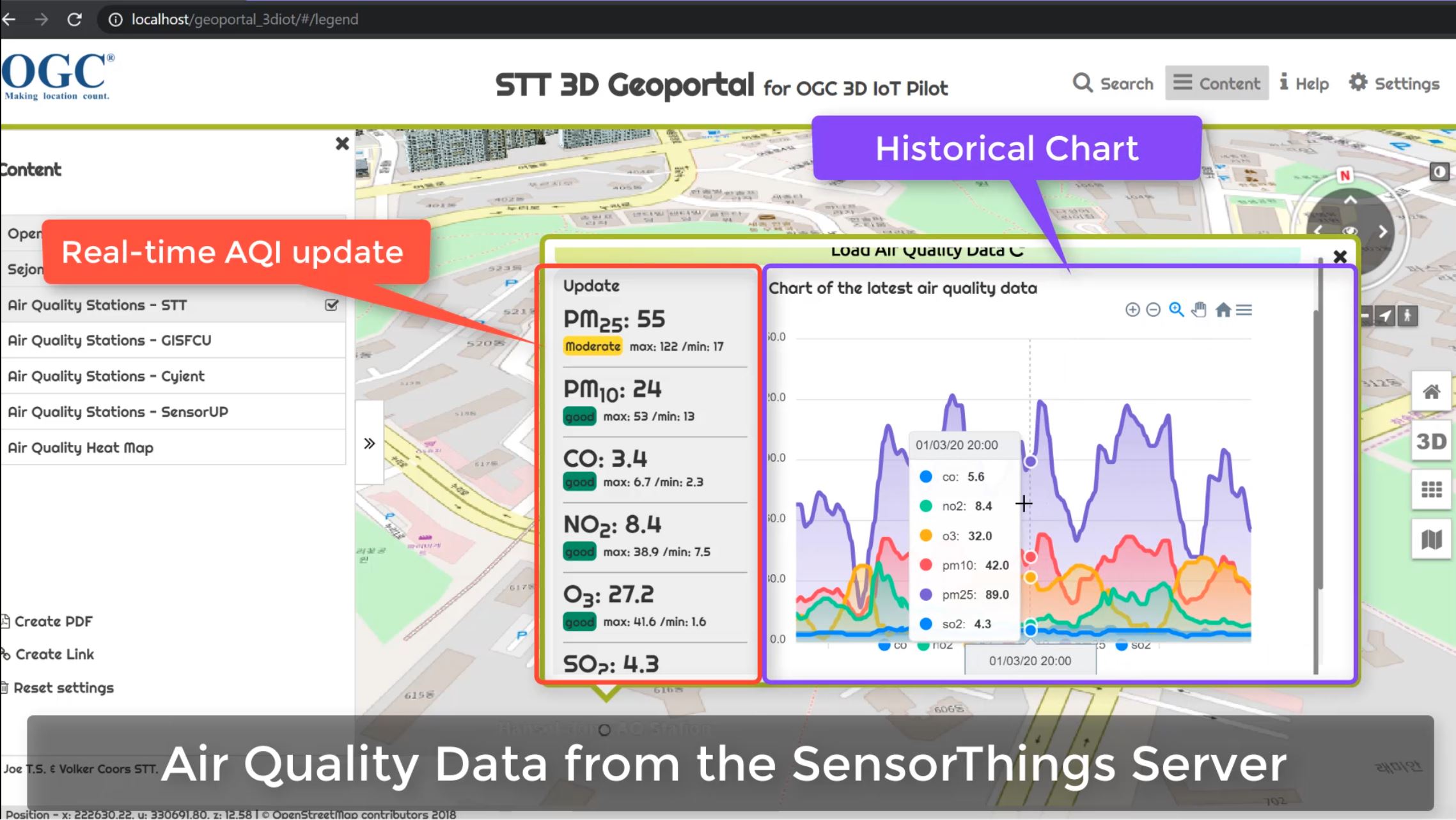
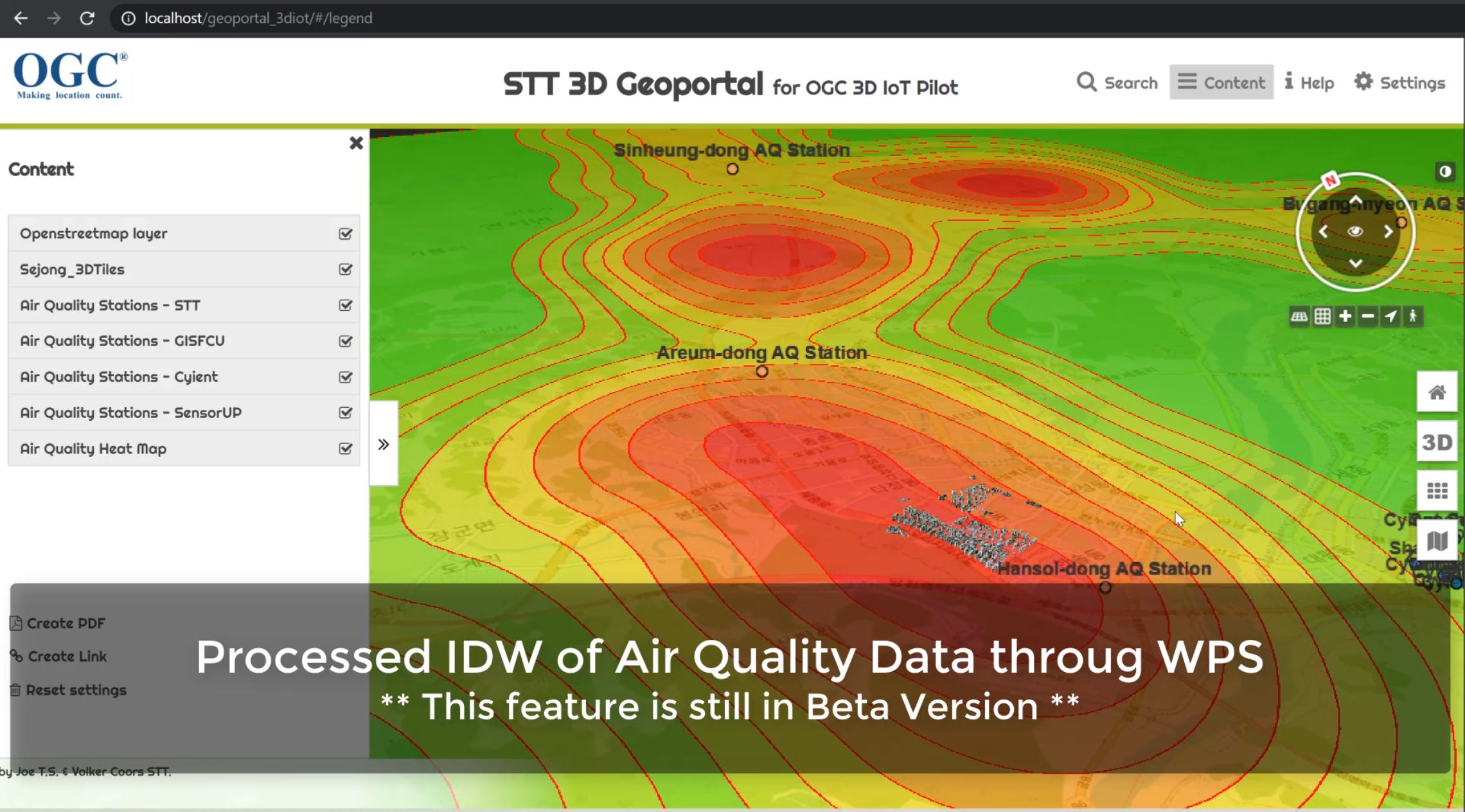
OGC 3D IoT Platform for Smart Cities Pilot
The goal of the pilot is to advance the use of open standards for integrating environmental, building, and internet of things (IoT) data in Smart Cities. Under this initiative a proof of concept (PoC) will be conducted to better understand the capabilities to be supported by a 3D IoT Smart City Platform under the following standards:
Important Links:
Demo on YouTube
To OGC Official Site OGC 3D-IoT Platform for Smart Cities Engineering Report
OGC CityGML Challenge 2019: Manchester3D
A team of HFT Stuttgart will participates in CityGML Challenge with Manchester3D web app. In this
challenge the Open Geospatial Consortium is
encouraging software developers to configure visualisation software tools to support the capabilities of
version 3 of CityGML, including dynamic data feeds from a range of sensors. The resulting tools and
visualisation environment are to be made openly available for one year for wider non-commercial
experimentation and innovation purposes, in particular as part of a Triangulum Innovation Challenge
focused on energy and mobility applications. Our app has several features including:
Visualizing sensor data feed from SensorThings API and other API provider.
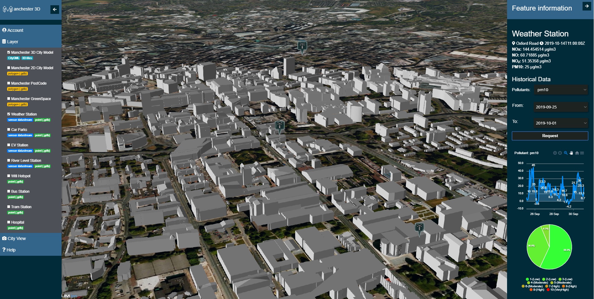
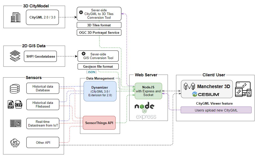
CityGML Web-Viewer (Drag&Drop)
Important Links:
To OGC Official Call Manchester3D Project Website
OGC Testbed 14: 3DPS and WFS 3.0
OGC Testbed 14 Complex feature handling ER has been published. It includes a prototype showing WFS 3.0
and 3D Portrayal Open API.
http://docs.opengeospatial.org/per/18-021.html
(and on github: https://github.com/opengeospatial/D040-Complex_Feature_Handling_Engineering_Report)
Important Links:
Demo Playlist on YouTube
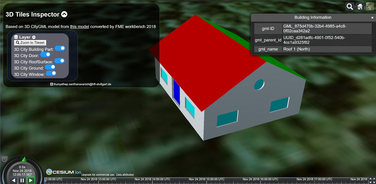
3D CityModel Viewer
An experimental "CityGML" viewer in Cesium, uses FME to convert CityGML to 3D tiles but keeps the
semantics of CityGML
Important Links:
Demo Application
Our Team


Joe T. Santhanavanich
Technical Leader
Organization: Hochschule für Technik Stuttgart
thunyathep.s@outlook.com

Rushikesh Padsala
Developer
Role: ArcGIS CityEngine | ArcGIS Enterprise | FME
rushikesh.padsala@hft-stuttgart.de
Athanasios Koukofikis
Developer
Role: ArcGIS Enterprise | I3S | 3DPS | Unreal Engine 4
koukofikis-athanasios@hotmail.com