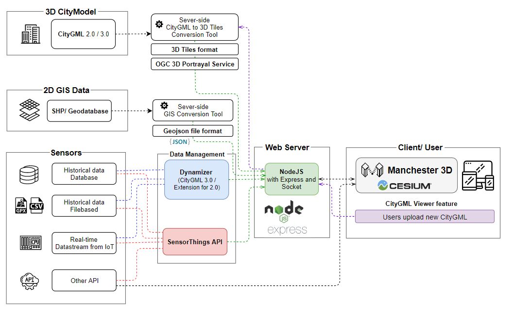
OVERVIEW
Manchester 3D is our vision of Digital Twin for the city of Manchester. Our aim is to design a flexible 2D/3D visualization platform that can provide a single view of all the city digital assets to different stakeholders. Manchester 3D platform is developed using open source technology and free software. We used data related to buildings (CityGML 3), infrastructure, and utilities (sensors) provided by Triangulum. Sensor data is accessed using Manchester-I API and integrated on-the-fly to enable seamless interaction of 2D and 3D city assets. The platform follows responsive layouts design principles and automatically adjust and adapt to any device screen size, whether it is a desktop, a laptop, a tablet, or a mobile phone and has the following 3 main sections:
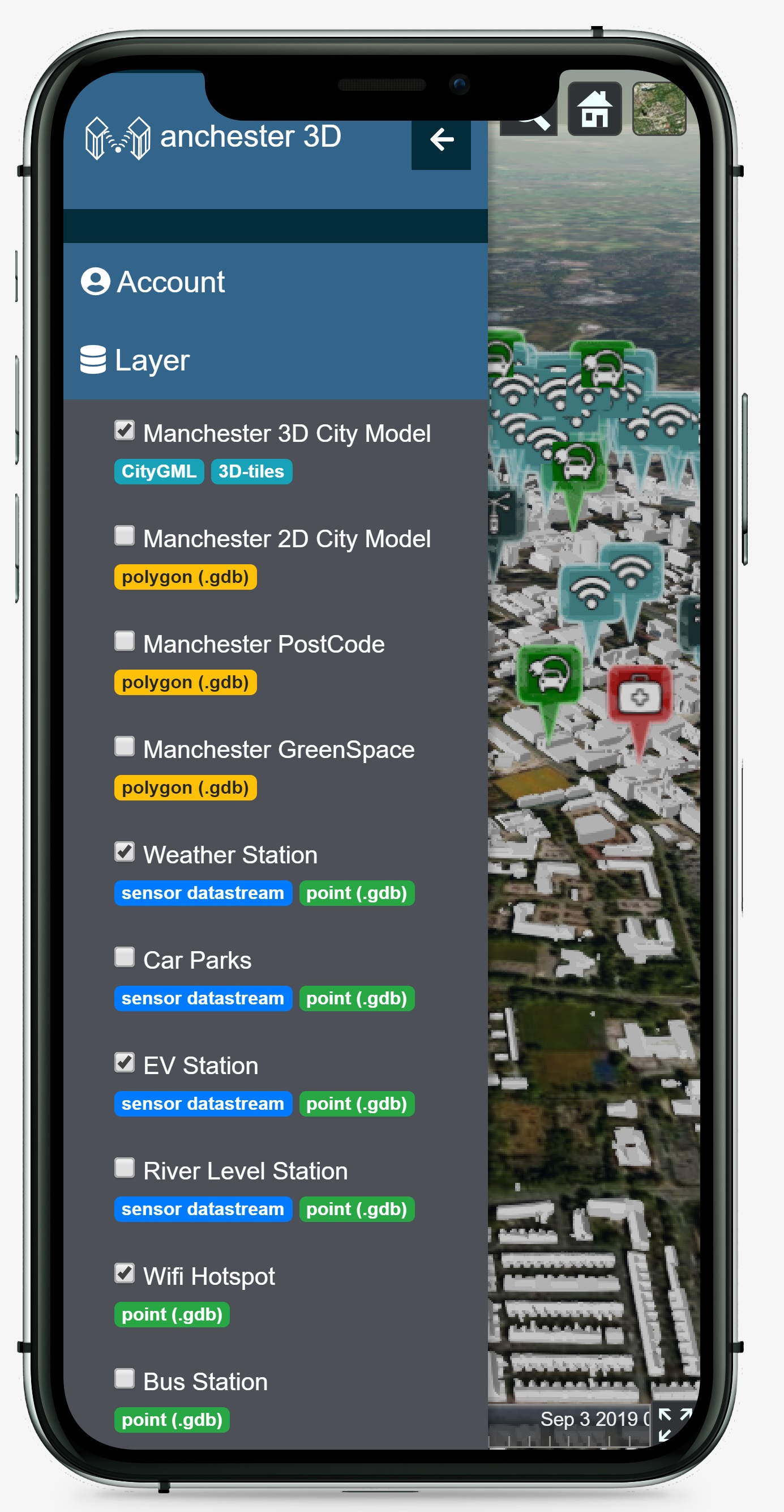
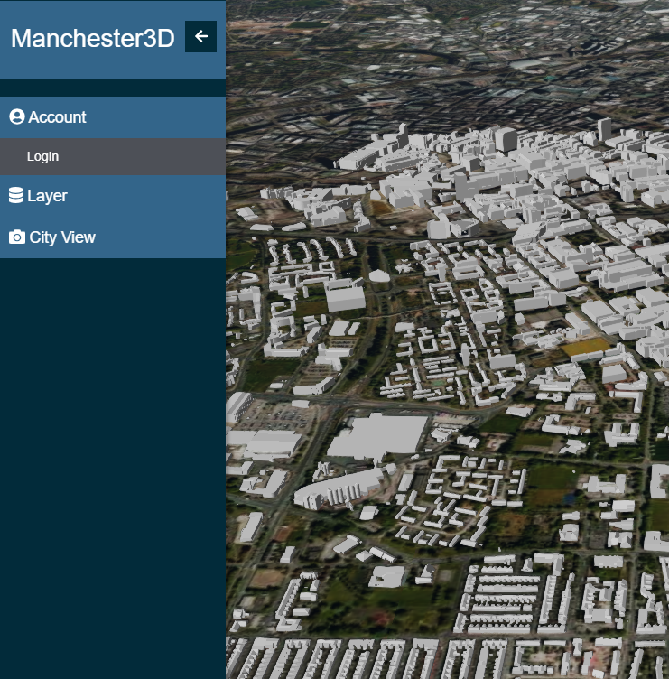
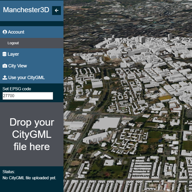
- Sidebar navigation section on the left, which will show up after users click on "Menu" on the top left corner. This is where users can see all the features offered by Manchester3D.
- Main view section on the middle.
- Data view section, which will show up after users pick any object from the main view.
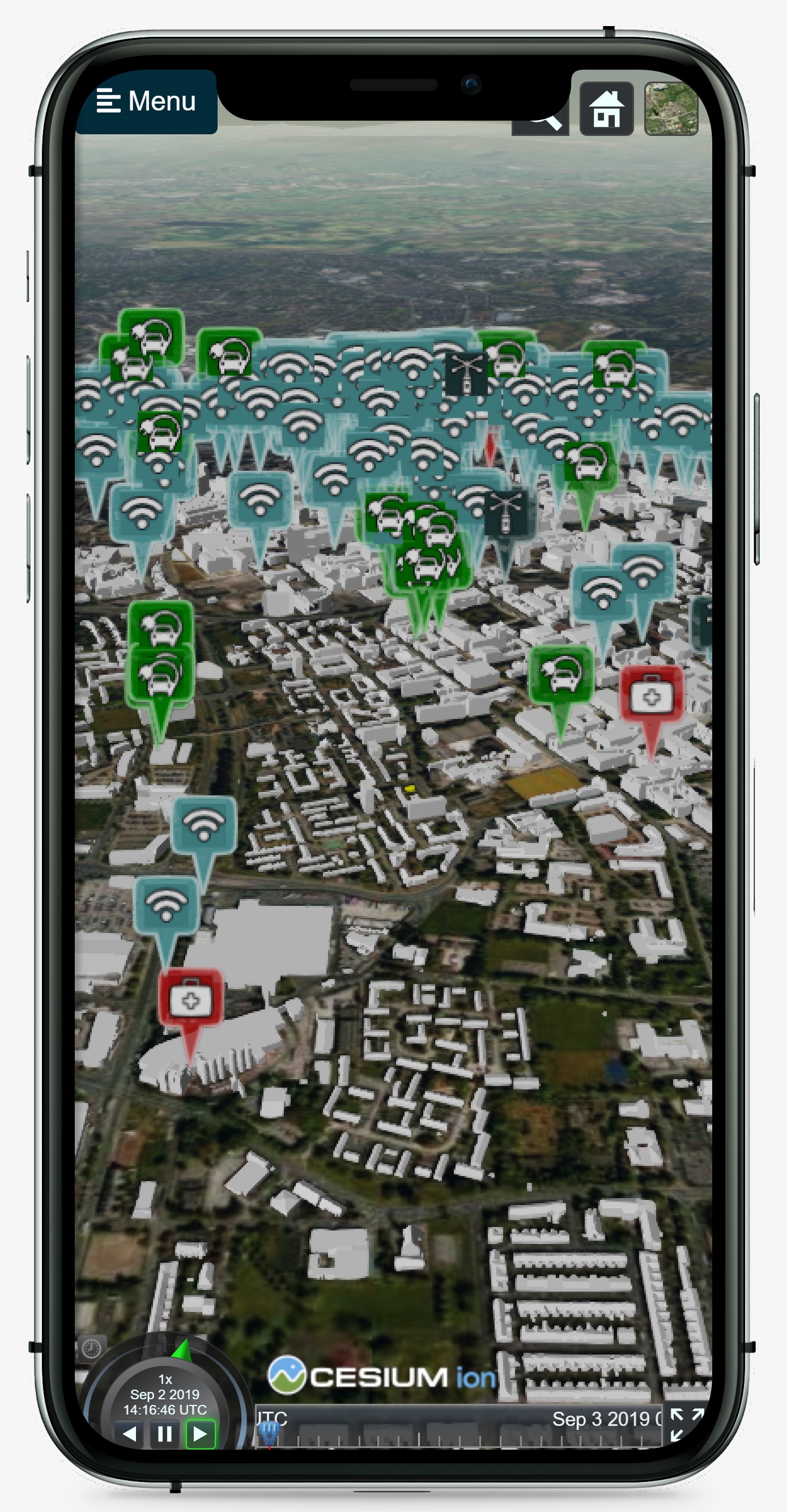
Despite the limited view, Manchester3D also supports mobile devices in portrait mode. For the best user experience, it is recommended to have at least 5-inch screen and 4GB RAM when accessing Manchester3D using mobile devices.
|
Show up after users click on "Menu" on the top left corner. |
Show up after users pick an object from the main view |
FEATURES
Here is a list of Manchester3D main features that can be accessed from the sidebar navigation section.
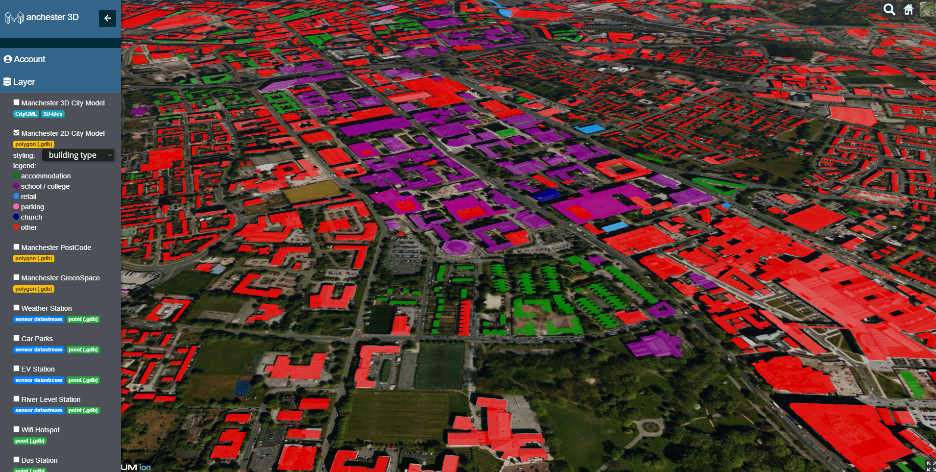
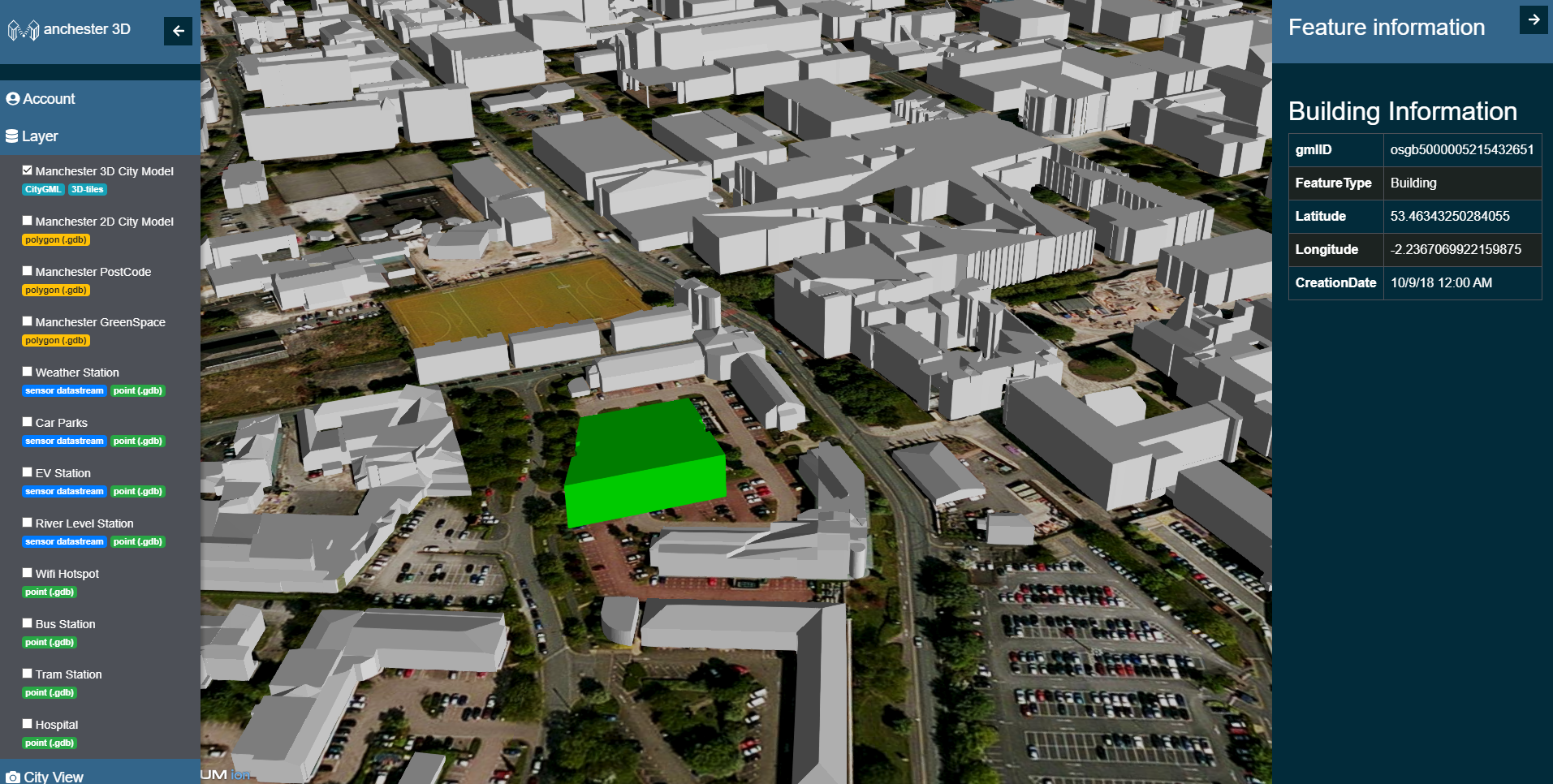
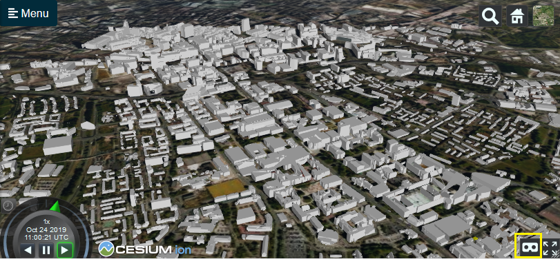
City Model Visualisation
Both building footprints and 3D model can be visualised.
|
|
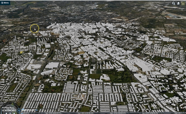
City View
Enables users to fly-through over the city so that they can have multiple points of views to see the city.
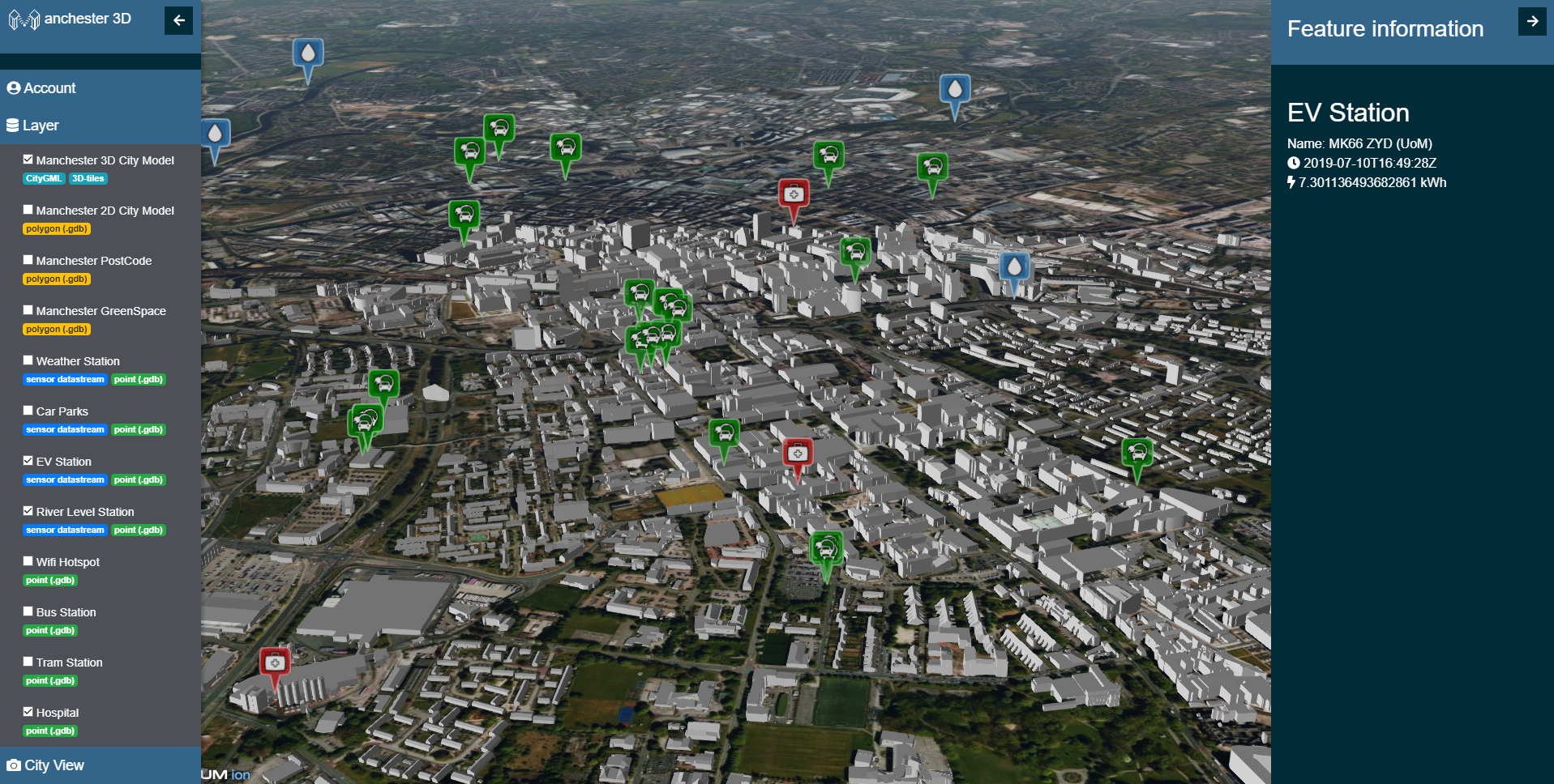
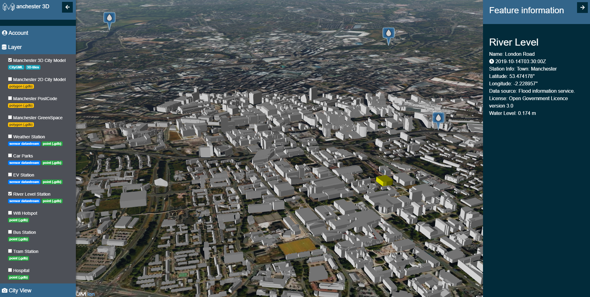
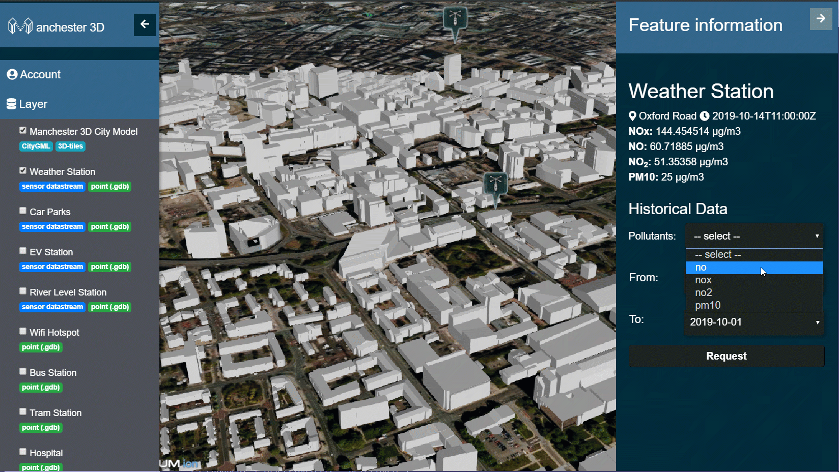
Data Visualisation
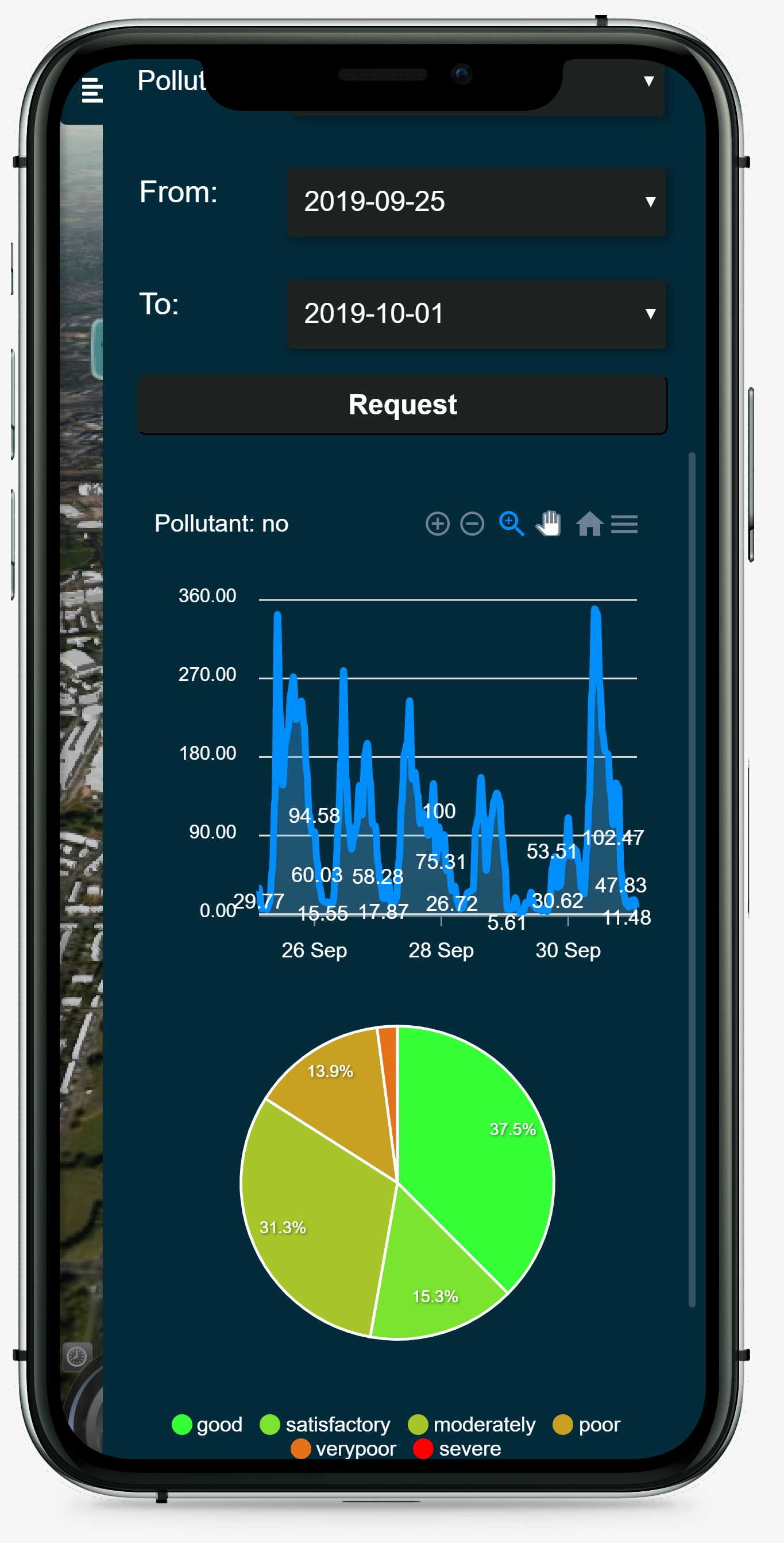
Allow users to pick the following various dynamic dataset of Manchester City to be overlaid on the city and view the metadata:
- Postcode
- Greenspaces
- Weather stations, along with historical data from each weather stations
- Car parks
- Electronic Vehicle charging station and its data
- Rivel level
- WiFi Hotspots
- Bus and Tram Stops
- Hospitals
|
|
Please note that this selection does not mean the capability of Manchester3D is limited only to viewing the already mentioned datasets. These datasets are chosen because they represent numerous type of data that is important (e.g., historical data, geolocation, air quality) to be presented for demonstration purpose.
*Drag & Drop to visual your own CityGML file
This feature allow users not only to view the city model provided by
CityGML Challenge but also to easily import their own CityGML 3.0 and view it in 3D Tiles format.
To use this feature, please go to Use your CityGML on sidebar navigation, set the **EPSG code, and then drag and drop your CityGML (max. 50 MB)
into the provided area.
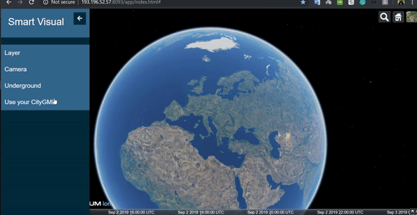
*You need to login to access this feature.
**For more references on EPSG code, please check out this website.
Login
To access admin view for demo purpose, please use the following credential:
username: admin
password:
password
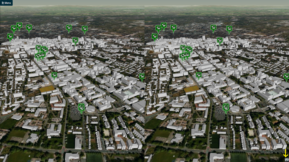
Virtual Reality
Virtual Reality (VR) mode allows users to step into a virtual city of Manchester using VR devices. This function can be easily activated by clicking VR button on the bottom right corner.
|
|
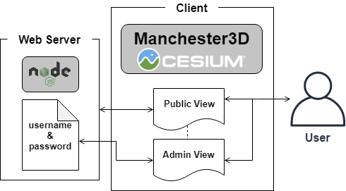
Back-end
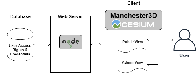
System Architecture
Role-Based Data Access (RBDA)
We implemented a simple login mechanism to demonstrate 2 different roles, admin and public, which have different data access. Admin users do not have any restriction, while public users cannot access Use your CityGML feature.
|
|
To have a comprehensive RBDA mechanism, we recommend to integrate a login system where user data, password, access-right are stored in a database, so that the data access can be managed dynamically. Upon a successful login, users should be directed according to their access-right. The login system must be compatible with NodeJS, since Manchester3D is built on it.
|
|